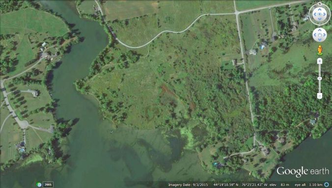
The ospreys have fledged and it is time to update our neighbours on the nesting success of the couples that build their “homes” along Colonel By Lake and the River Styx. Here are the locations from 2002 to the last update of 2013, three years ago. What has changed in the last three years? This is the latest for 2016.

The “big star” in this map is the couple that started their nest in 2002, the first osprey settlement on Colonel By Lake since we monitored them. Jack Colden had erected a telephone pole with a 6×6 nest box on top two years before and in 2012 the couple started to make their home. For more click here.
The nest toppled over in the spring of 2014 just before the arrival of the birds from their wintering grounds in Florida. The pair moved to another empty platform about 200 meter to the east, also set up by the Coldens just as an extra site , in this case a good backup. There, the ospreys successfully hatched two young each year from 2014 to 2016. This couple produced over the years more than thirty offspring. Survival rate in the first year is about fifty percent, so probably fifteen or more of their young have families now and some of these are around our area on Colonel By Lake and the River Styx.
 This is the original nesting area on Colonel By Lake. The parents might be the 2002 originals. Here one parent and a young is shown, the other young is inside the deep nest and the second parent is hunting for food. Photos by Henk Wevers.

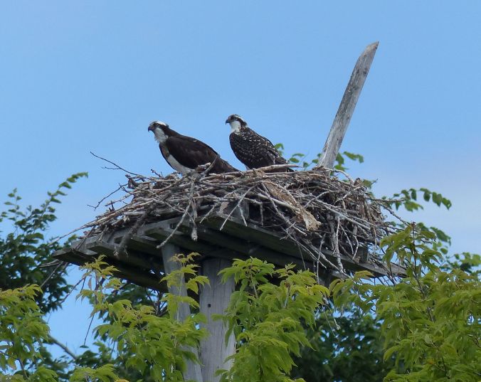
At the end of June and early July the first chick is almost the 2/3 the size of an adult and they start to flex their wings. First one, then the other wing can be seen spreading awkwardly over the edge of the nest. This young is almost ready to fledge and leave the nest which happened a few days later on July 21. The family does gather around 6 pm for supper and one can see the two adults and two young on the nest, eating and hanging around…
On the River Styx …
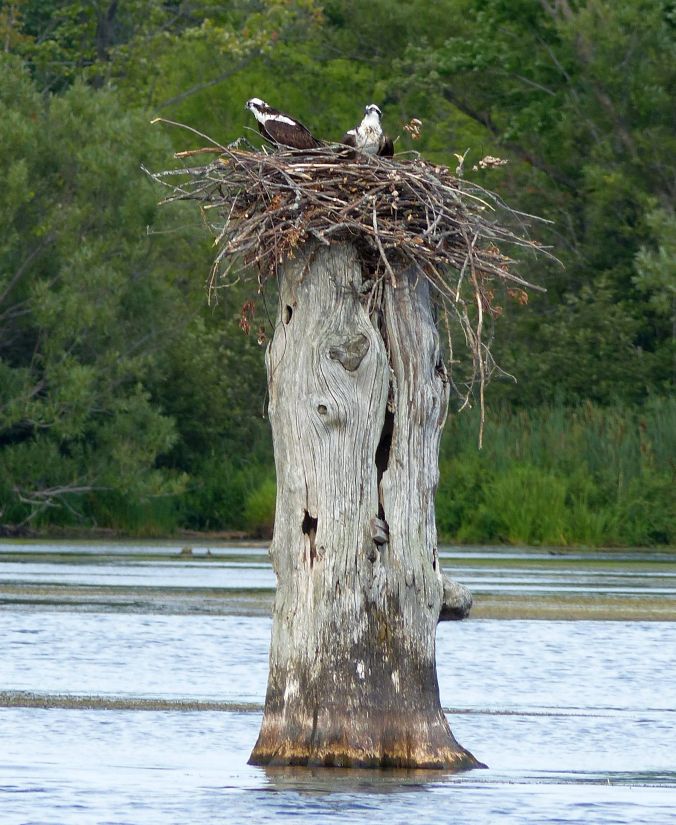
 A couple have built their nest since 2011 on this large dead tree stump dating from the time that the Rideau Canal was built. It sits in a large bay a the north-west end of the river. In this photo one parent is hunting while the other watches over two young. The young sit side by side their bodies seemingly one with the youngest in front of the older sibling. in front of that pair it looks like there is a third young a body with dark juvenile feathers is crouching low in the nest. Anyway this couple has been very successful in producing young during the last five years. Note the difference in size between the oldest and younger siblings.
Other nests on the map have disappeared over time some because the natural trees they had used to build their nests toppled over in mid-season, or might have been raided by raccoons. These nesting sites were abandoned the following year. One nest at the end of Aragon Road that the Keirsteads erected on the side of the canal was abandoned in the early breeding season in 2015 and 2016. Two years before that the couple produced two young each year for three years in a row.
Lately we see them huddling together on a tree stump enjoying the fruits of their work building a robust nest. Hopefully this will be their next year’s domicile at the entrance to the canal between Colonel By Lake and the River Styx.

It is amazing how they have woven the branches together to make a nest that can withstand the winter. One would think that a couple that can built such a nest would be successful in hatching two or three chicks and bringing them up to young adults that can migrate this coming September to winter ultimately in Florida or somewhere along the Atlantic coast or other open water, during our winter.
+++++++++++++++
New to our area is a Bald Eagle couple that was discovered by Mark Fleming in the early spring of this year. Its nest is located in a large mature white pine tree near the marsh at the north-west corner of the River Styx. That is also the location of a couple of Mute Swans who swam around that corner of the Rideau with three young and then later only two. There are many more breeding Mute Swans along the river going towards Lower Brewer Mills Locks. Bald Eagles are also observed along the Rideau Canal in the quiet wetland areas of the large lakes farther east, according to Parks Canada staff.

A young bald eagle photographed by Mark Fleming one of our neighbours on the Aragon Road who is a serious nature photographer who takes his kayak out on the water to scout for wildlife in the marshes and shallow water of Esther March Bay and the River Styx and parts of Colonel By Lake. For more photos of the bald Eagles click here.
++++++++++++
To go to the INDEX, click on the icon below another photo of the Bald Eagle by Mark Fleming.

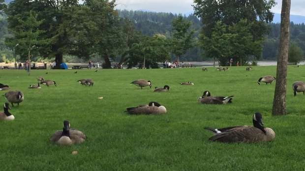
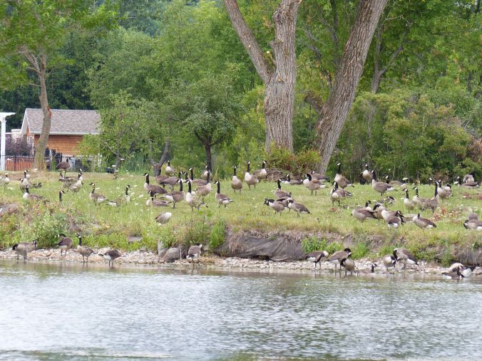 Just under a hundred visitors. That’s a bit less than a hundred pounds of fertilizer aka “CGP”. The photo was taken after the owners of this house opened up their view of the lake by uprooting the shrubs along their shore line. Then they improved the lawn to reflect a city park and presto, the Canada Geese moved in. Notice the inviting shoreline with its low slope up to the short cropped grass: the geese’s salad bar.